How to Read Maps: Zion National Park
For Middle and High School
$3.50$3.00
Explore the wonders of Zion National Park with 'How to Read Maps: Zion National Park'—an engaging educational tool designed specifically for middle and high school students. This comprehensive resource is packed with detailed maps, complete with keys and legends, that make mastering map-reading fun and easy. Enhance your navigation skills while discovering the breathtaking geography of one of America's most iconic parks. This activity is perfect for both classroom learning and adventurous field trips.
It is important for students to know how to read a map. There are several things that are included in most maps such as latitude, longitude, compass rose, key (legend) and a scale. There are also several types of maps such as topographic maps and thematic maps. In this activity students will learn all this and more about maps. There is also an optional quiz, to test for understanding.
First, students will read a 2-page passage about the importance of reading maps and the four things that are usually included on a map (latitude/longitude, compass rose, keys and scales). Then, they will use what they read to answer fourteen questions, including practice questions about a provided map.
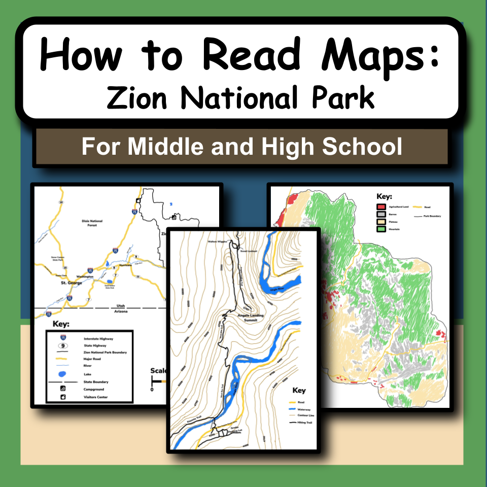
Next, students will use three provided maps of various areas in Zion National Park, descriptions of the maps and answer eight questions about them. The first map is a road map of Watchman Campground. The second is a topographic map with contour lines of the Angels Landing trail hike. The third is a thematic map of Zion National Park of the regions in the park (plateau, mountain, barren, etc.).
Then, students can answer the 10 questions in the Reading Maps Quiz Study Guide to prepare for the provided Reading Maps Quiz. It is a 10 question quiz about the vocabulary that the students learned (i.e. "Scale," "Contour Lines," "Topographic Map," etc.).
There are teacher tips provided to show how this activity can be done individually, in small groups, or as a whole class, depending on how you want to conduct the activity packets.
This product includes:
Teacher Directions-including prep info and materials needed
Teacher Procedure
Two Student Packets-Reading passages, analysis questions, three practice maps
Student Packet Answers
Map Quiz Study Guide
Study Guide Answers
Reading Maps Quiz
Map Quiz Answers
Teacher Tips
Websites and Citations
To do this activity, you will need:
Pencil
Copy of “Map Basics” packet for each student (INCLUDED)
Copy of "Reading Maps: In Zion National Park" packet for each student (INCLUDED)
Copy of "Reading Maps Quiz Study Guide" for each student (INCLUDED)
Copy of "Reading Maps Quiz" for each student (INCLUDED)
Also, check out my Youtube Channel for FREE informational videos about the national parks along with FREE video guides for your students!
Join my email list here to learn about ways to encourage students to experience the content!
You can also follow me on Pinterest, Instagram, Facebook and YouTube!
If you have any questions, feel free to email me at edventureswithmrsd@gmail.com.
Thank you!
6th-12th
Science
General Science
National Parks
Earth Science
Map Skills
Geography
Social Studies
20 Pages