Tectonic Plate Boundaries: Science Map Activity
For Middle and High School
$3.25$3.00
Unlock the mysteries of Earth's tectonic plates with our engaging Tectonic Plate Boundaries Map Activity! Dive into the fascinating world of geology as you read about tectonic plates and use provided clues to outline different boundaries on a detailed map. This hands-on activity is perfect for students, educators, or anyone with a keen interest in Earth's dynamic crust. Make learning fun and interactive with this unique educational tool!
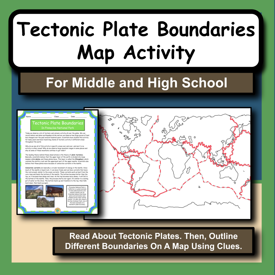
Pinnacles National Park is a great example of what tectonic activity can do to the landscape. Pinnacles is close to the San Andreas Fault, which is on a transform plate boundary. There are two other types of tectonic plate boundaries: convergent and divergent.
In this activity, students will learn about plate tectonics, convection currents, plate boundaries: transform, convergent and divergent, and examples of these boundaries such as the San Andreas Fault (transform), Iceland (divergent), and Nicaragua (convergent).
Then, students will read clues about certain plate boundaries; they will identify what type of boundary it is and then outline the different types of boundaries on a map of the world. The map includes labels of the specific places that are listed in the clues.
For example, a clue might read: "There are numerous volcanoes and mountain ranges along the west coast of Central America." So, students would identify this as a convergent plate boundary and they would outline the boundary on western Central America with the convergent boundary symbol (listed in student packets).
Finally, students will answer several analysis questions based on what they learned in this activity.
This product includes:
Teacher Directions-including prep info and materials needed
Teacher Procedure
Student Packet-Reading, data tables, plate boundary clues, student blank map, analysis questions
Student Packet Answers
Map Answer
Teacher Tips
To do this activity, students will need:
Pencil
Copy of student packets (INCLUDED)
Optional: access to a world map (i.e. textbook, wall map, computers, etc.)
Also, check out my Youtube Channel for FREE informational videos about the national parks along with FREE video guides for your students!
Join my email list here to learn about ways to encourage students to experience the content!
You can also follow me on Pinterest, Instagram, Facebook and YouTube!
If you have any questions, feel free to email me at edventureswithmrsd@gmail.com.
Thank you!
7th-12th
Earth Science
General Science
Geography
Tectonic Studies
12 Pages
"This is such a great resource! My students really enjoyed it and it was also very helpful in students understanding the material!" Mrs. Jordan
"Very well made activity, used with a group of 3 private students. They all worked together and were really engaged doing it." G and C.
"My science teacher friend was looking for a resource, so I suggested this one; we paired up together, and the kids were absolutely engaged when we went through this together. I highly recommend this!" Mrs. F.
"Very thorough lesson plan. It makes it simple to teach and the comprehension questions are great! I love that the students get to label their own map." E.F.
"I used this as a way to engage students in their natural disasters learning. They found it really interesting exploring the boundaries and linking them to fault lines! Thanks so much - brilliant resource!" PT.